
View Rating - 10 out of 10!
Distance - 5 miles round trip
Elevation Gain - 1800 feet
Highest Point - 8700 feet

Do you want to know what may well be the single most spectacular hike in Tahoe? Better, even, than Mt. Tallac or the Sand Harbor Overlook near Herlan Peak? A hike the summit of which is almost deserted? Try the Bayview Trail up to South Maggie's.
"Wait," I hear you saying. "What could possibly be more spectacular than hiking Mt. Tallac?"
A reasonable question, especially since Mt. Tallac's summit is 1000 feet higher. But Mt. Tallac is twice as far from Lake Tahoe as is South Maggie's. And South Maggie's looms directly over Emerald Bay, which many people think is the most spectacular part of Lake Tahoe. Ask people who've done both hikes, and you'll find that many agree with me. South Maggie's Peak simply offers a more dramatic view, which happens to also include a great look at Mt. Tallac!

The beginning of this hike from the Bayview Trailhead is in most trail guidebooks. But the end - the last portion up to the summit of South Maggie's Peak - is not. The likely reason is that the final portion isn't a well-constructed trail, and the Forest Service doesn't like hikers to go just anywhere because that leads to erosion. In fact, they won't like that I'm telling you about this hike. (But I'll also tell you how to mitigate your impact so you don't have to feel guilty!)
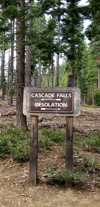
Here's where to go. At Emerald Bay, don't park at the Vikingsholm lot or the Eagle Falls Trailhead lot. Instead, drive to the southernmost part of the highway around Emerald Bay and pull into the Bayview Campground lot directly across from the popular vista point overlook.


Continuing up the trail, you come to Granite Lake, hiding at 7500 feet below Maggie's Peaks. Granite Lake is a great place to take off your shoes and cool your feet on the way back down.

As the trail rises above Granite Lake, you move into a forest of giant California Red firs. These grow to 6 or more feet in diameter as you approach 8000 feet of elevation (their climate sweet spot).

Here's a Red fir with a giant burl that allowed me to pretend for a moment that I was King Louis the Sixteenth, sitting on his throne.
The trail zig-zags up a serious slope to the saddle that lies between North and South Maggie's. To the north and west, you can see much of Desolation Wilderness spread out below you. Don't go too close to the overlook (BE CAREFUL!)

Here, I'm trying to channel John Muir. 1000 feet below me is Eagle Lake, a popular destination up the Eagle Falls Trail. PLEASE NOTE THAT ONE CAN FALL FROM ROCKS LIKE THESE! HANG ONTO YOUR CHILDREN IF YOU GO NEAR DROPOFFS!

From the saddle, the trail continues southwest. In just 100 yards or so, we are going to leave the trail and strike up the open forested slope to the left.

Turn left off the trail and just head up. If you only go up, you can't miss the summit. Because there isn't a formal trail, erosion is a concern. You can avoid creating a path that would channel water and cause erosion by simply walking carefully up at a gentle angle, zig-zagging up the slope as you would if you were climbing on cross-country skis. It is the more direct, steeper paths, caused by hikers and mountain bikers alike, that contribute to erosion. A "Leave No Trace" philosophy prevents erosion just as it prevents litter.

When you near the summit of South Maggie's, head for the north (left) portion. The views are better, and the perfect lunch spots more numerous. To the left rear is Lake Tahoe and the town of South Lake Tahoe adjacent to it. Front left is Cascade Lake, a private lake where John Steinbeck once wintered and wrote (and did some serious drinking!). Rear right is Fallen Leaf Lake. In the distance is Heavenly in the center left and the Freel Peak massif on the right. At 10,880, Freel Peak is the highest mountain in Tahoe.
Speaking of lunch...

Turkey, tomato, spinach, and cheddar on a whole wheat ciabatta roll.
If that sounds too healthy, don't worry, we took the edge off the health
quotient with a whole lotta chips!
 |

After lunch, plan to take some time to memorize the view. And what a view it is!
Great blog! Thanks for sharing. A quick question if you don't mind? Is the trail 'safe' for younger children. My boy is 8 and in good shape, but I was wondering if it's easy to fall of the trail (literally)... Are there a lot of spots were you could fall and go spiraling downhill rather quickly. We are thinking this Saturday, but can't get there early.. Think we will try anyway... Again, great blog with lots of great tips.. Great stuff!
ReplyDeleteHi Rob,
DeleteGood question!
Most of the trail is safe and well-graded, and the trail itself is not especially slippery. BUT YES, THERE ARE A FEW PLACES WHERE A KID OR ANYONE ELSE COULD FALL OFF! These are especially at the top as well as at the saddle. See the photo above where I'm looking down at Eagle lake 1000 feet below.
Personally, I would take a kid up the trail, but I wouldn't let that child out of my sight, and I would hold the child's hand whenever I came close to those areas.
Think of it like walking with a child in a busy city. You hold the kid's hand whenever you cross the street.
If you are vigilant, the Bayview Trail is a great hike for anyone.
Have fun!
Todd
Great! Thanks Todd, looking forward to this!
ReplyDeleteDo you think it is maintained during the winter?
ReplyDeleteHi Linda,
ReplyDeleteThanks for your question.
No Tahoe trails/hikes are maintained during the winter. This one is currently buried under 12 feet of snow, and last I checked, the road to Emerald Bay was closed due to avalanche danger.
It was an oversight on my part not to mention that most of the hikes I write about are only accessible beginning in May or June or even July. Too much snow.
Sorry for the omission. Tahoe locals forget that other people don't know that.
I hope you enjoy the hike come July!
Todd
Is this hike dog friendly?
ReplyDeleteGood question. Yes, this hike and others in the Desolation Wilderness are dog friendly! However, your dog needs to be under vocal control or on a leash. If your dog bothers other hikers or horses or other dogs, you can be ticketed. Dog waste needs to be packed out or buried 8 inches deeps at least 200 feet from any water. And, like most hikes in Desolation Wilderness, this hike goes over rocks, so your dog needs tough paws. If you have any doubts about your dog's feet, bring dog boots and check your dog's paws frequently on the hike. We've known people who went too far and their dogs bloodied their paws necessitating carrying the dog out. If your dog weighs very much, that can be difficult if not dangerous. With care and preparation, wilderness hikes are fantastic places to bring dogs.
DeleteEnjoy!
Todd