Showing posts with label Best Hikes. Show all posts

Sunday, April 4, 2021

Spring Hike/Walk Without Snow

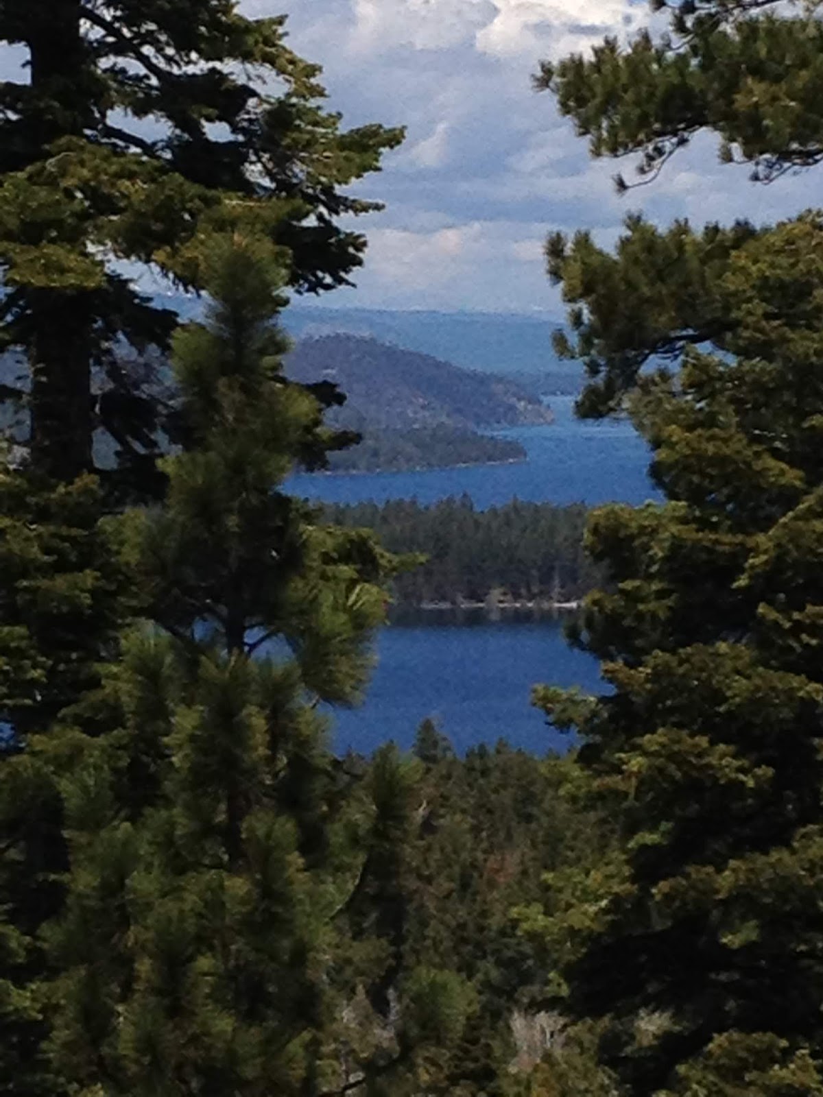
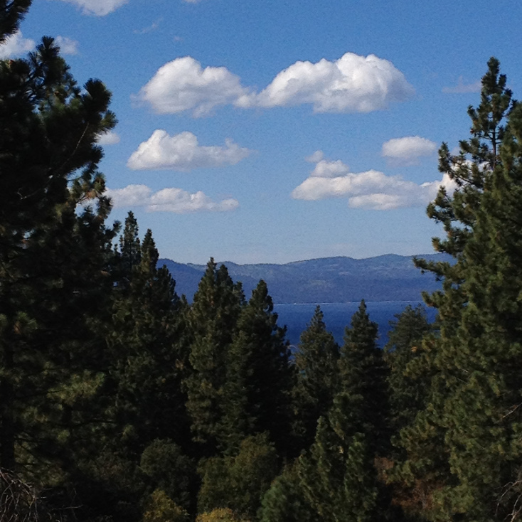
 Are you a hiker? Are you coming to the South Shore? If you want a place to go for a nice long walk that isn't buried in snow and has gorgeous views, come to the Tallac Historic Site. There are very few tourists this time of year, and the views across the lake are grand.

View of Mt. Tallac, the biggest mountain directly on the shore of Tahoe.

How to get there?

At the "Y" intersection where Emerald Bay Road turns north from Lake Tahoe Blvd., drive northwest out Emerald Bay Road. About three miles out, look for signs for Camp Richardson. There's a General Store, a classic old hotel, lots of cabins, etc.

When you go past the General Store on the right, continue a quarter mile or so and watch for the sign to Valhalla, again on the right.

Just after the turnoff (which is closed) to Valhalla, there is a gravel parking lot on the right where you can park. (There are also many other places where you can simply pull off the highway and park.)

From wherever you park, you will find numerous trails and paths and roads that head north to the shore of Lake Tahoe. When you get to the lake (about a quarter mile) head west along the shore. Take your time exploring. You will find the Heller Estate: https://valhallatahoe.com/valhalla-grand-hall/ , the Pope Estate, the Baldwin Cabin, multiple beaches etc.

Enjoy the old-growth Ponderosa Pines at Valhalla, monster trees that are 7 feet in diameter. Check out the spectacular view of Mt. Rose and the surrounding mountains, 30 miles north. And of course, there is nearby Mt. Tallac, the tallest mountain that sits directly on Lake Tahoe.

You will find miles of snow-free trails and beaches worth exploring. This time of year, you can enjoy these places like locals, unencumbered by the hordes of tourists that will descend come July.


Sunday, December 6, 2020

Hiking In The Coronavirus Era

Simple adjustments for public and personal health...

My wife and I do a lot of hiking. When the pandemic began, we were like most people, wearing masks when we went inside a store or the post office and not wearing masks out on the trail. I was more resistant to wearing masks outside than she was. I reasoned that outdoor air represented so little threat that there was no comparison between hiking and shopping for groceries.

However, as the situation worsened, I realized that for everyone's comfort, it is best to wear a mask when you encounter people, even when outdoors in the mountains. Now, it is the law in many places.

Of course, hiking up a trail, breathing hard in the high-altitude air, a mask can be very frustrating. So I've developed a simple approach that has become second nature. If it's cold enough that I'm wearing a knit cap, and no one is in the area, I unhook one ear from the mask and let it dangle from the other ear. My knit cap holds the remaining ear string in place As soon as I sense someone approaching on the trail, I rehook the mask on both ears.

If I'm not wearing a knit cap, I simply carry my mask by one ear string. At the first sign of people, it's ready to go, and I can hook it into place in about one second. Yes, even describing this process feels uncomfortably prosaic, like I'm suggesting how to tie one's shoelaces. Yet, it has made my life easier. So I pass it on.

Let's hope that in the next year or so, we won't be having to think about it at all!


Sunday, May 24, 2020

Amazing South Shore Hiking

Some hikes are worth going back to again and again. One of those is Angora Ridge. I wrote about it before. Here's the link to that posting:

http://toddborg.blogspot.com/2013/04/best-hikes-in-tahoe-angora-ridge-lookout.html

However, that write-up was about going up Angora Ridge Road, a pleasant walk but one with few views until you get near the Angora Fire Lookout.

Since that time, a "single track" trail was built to the northwest of the road. And the views from that trail are amazing all the way up.

To get to the single track, go to the entrance to Angora Ridge Road. (Google Maps 'Angora Ridge Road, Dundee Circle, Tahoe') Zoom in to the intersection where Angora Ridge goes southwest from Dundee Circle.

At that intersection, look for the Forest Service gate, which is only open during summer months. To the right side (west) of the gate is the hiking/biking single track. It doesn't have a super obvious trailhead sign. But it isn't hard to find.

While Angora Ridge Road follows a shallow valley (blocking the views), the single track goes up the ridge just north of the road.

The lake directly below is Fallen Leaf. The lake in the distance is Tahoe.
The mountains in the distance are the North Shore mountains, 30 miles away.
This is Mt. Tallac, directly across Fallen Leaf Lake, which is directly below us,
visible all along the hike, but out of this picture unless you look almost straight down.

This is Pyramid Peak, part of the Crystal Range,
all of which is visible from the Angora Fire Lookout.

Trust me, you will be amazed at the views, and they continue all the way up to the fire lookout, which of course has its own amazing views.

By any measure, The Angora Ridge Single Track is one of the Top 10 best view hikes in all of Tahoe. If you're looking for short view hikes, I put it in the Top 3.

P.S., Yes, a few mountain bikers use the trail, but we've found them to be courteous. We just step off the trail and let them pass.


Sunday, September 23, 2018

Oh, Yeah, Time To Revisit...

There are many places in Tahoe worth revisiting again. And again. This is one of them.


The Rubicon Trail is accessed from D.L. Bliss State Park on the West Shore, just north of Emerald Bay. Because Rubicon Point is the tallest underwater cliff in the lake - 1000 vertical-foot-wall dropping under water - the depth gives the water an amazing color.


Note the two stand-up paddle boarders off the rocky point.


Much of the hike is substantially above the water, so you have many opportunities to look straight down into that amazing blue.

If you want more details, here's a link to a post I wrote four years ago:
http://toddborg.blogspot.com/2014/10/best-hikes-in-tahoe-rubicon-trail.html

Enjoy!

Sunday, June 3, 2018

New Trail Up Angora Ridge

I've written before about Angora Ridge Road here. It leads up to the old Angora Fire Lookout and some of the world's best views looking down at Fallen Leaf Lake and across at the peaks of the Crystal Range.
The hike gives you views of Mt. Tallac, all the way up.
The hike always used to be along the Forest Service Road that climbs up to Angora Lakes Resort. It's a wonderful hike and great for chatting with your companions. However, when the Forest Service opens the gate in the summer, there can be many cars crawling up the incline.

However, now there is an alternative, a single track hike that leads to the same lookout but does it along the west edge of the ridge. This means that instead of being in the small valley that shelters much of the road, you are on a ridge with views all the way up. The improvement in view goes from spectacular to REALLY spectacular.

The water in the foreground is Fallen Leaf Lake.
The distant water is the West Shore of Lake Tahoe.
To get to the hike, follow the directions in my earlier post (link in the first line above). When you are standing at the entrance to Angora Ridge Road and facing the gate, don't walk toward the gate. Instead, walk the main road (Tahoe Mountain Road) downhill 20 yards to your right (toward the west). Then look to your left. You will find a trail head (unmarked as of this writing). The trail immediately goes up in gentle switchbacks. Almost immediately you start to get great views, which grow in grandeur and stay with you all the way up.

You will be looking across Fallen Leaf Lake toward Mt. Tallac and north up the West Shore of Tahoe in the distance. Bring your "Wow" meter, because views don't get better than this.

This was our view from our lunch spot up next to the fire lookout building.
Looking down at Fallen Leaf Lake is like looking down at a Norwegian Fjord. Gorgeous.

The trail eventually puts you back on the road. Be sure to continue up to the old fire lookout buildings and walk up to them so you can look out across at the Crystal Range, the highest West Shore mountains in Tahoe. In the distance above you, you'll see an almost year-round snowfield, where lies Lake Aloha. For those of you who drive Highway 50 home, you can't miss Horseshoe Falls as you come around the big curves from below Echo Summit toward Twin Bridges. That spectacular falls is the water that flows out of Lake Aloha.

Enjoy!

P.S. I learned about this new trail last fall on our daily Tahoe news source: https://www.laketahoenews.net/

Check it out. Even locals like me continually learn new stuff about Tahoe!

Sunday, October 23, 2016

Best Hikes - South Shore - Van Sickle Park


Category - Easy
View Rating - 3 out of 10
Distance - Any distance you want, as this is an out-and-back round trip. Turn around when you desire. One of the easiest vista points is one half mile from the main parking area. If you're walking from a Stateline hotel, add another half mile each way. If you go to the Tahoe Rim Trail, it is about 5 miles round trip from the main parking lot.
Elevation gain - 200 - 1500 feet for the basic trail.


Let's say you're staying on Tahoe's South Shore near the state line, which features the city of Stateline, NV to the northeast of the line and Heavenly Village to the southeast of the line. This is where Tahoe's greatest concentration of hotels and motels are.

Now let's say you'd like to go on a nice hike but don't want to have to figure out transportation to a trailhead. No problem. There's a great hike within easy walking distance from your hotel. In less than 1 mile from your hotel, you can walk through the nearby forest to wonderful views. In less than 2 miles, the views are more expansive.

Years ago, the Van Sickle family donated their 542 ranch to provide for a park. The result is a very nice facility within walking distance from the busy hotel corridor near the state line.

The forest trails are relatively easy, the views are nice if not spectacular, and best of all, you can skip the car and walk from any of the area hotels.

To get to Van Sickle park, look for where Park Avenue crosses Hwy 50 (Lake Tahoe Blvd.) On the east side, what used to be Park Avenue is now called Heavenly Village Way. Walk east on Heavenly Village Way a long block to a four-way stop sign. The entrance to Van Sickle Park is straight ahead. (It is not well marked!)

Follow the red car straight into Van Sickle Park
When you get to this old barn, take the turn to the left.

This is the road that leads to the main parking area.
There are restrooms and information signs near the parking.
Look for this single trailhead sign. The main trail heads up behind the sign.
The sign has a map of the trails, of which there are several.
The trail is a single-track, but it is easy to navigate.

Watch for this sign and a trail that leads to a great overlook up on the rocks.
(Be careful at the top and use your hands for support. If you are unsure, don't climb up on them.)

This is the view to the left. The mountain on the left is Mt. Tallac. Maggie's Peaks are in the center.
Jakes Peak is to the right. Emerald Bay is tucked in below Maggies and Jakes.

View to the center
View to the right, with the casino hotels visible


As you continue up the trail, you come to the burn path from the Gondola Fire from several years ago. Someone tossed a cigarette butt out of the gondola, which started a huge forest fire that threatened all of the homes on Kingsbury Grade.
Van Sickle Park has multiple trails worth exploring. You can walk all the way up to the Tahoe Rim Trail, which you will intersect near the ski lifts on Heavenly's Nevada side. From there, if you like, you can continue to Tahoe's grandest hikes and mountains. For example, it is possible to hike all the way to Freel Peak, a 30-mile round trip, which, at 10,880 feet, is Tahoe's highest mountain and would require a 4,500-foot elevation gain from Van Sickle Park. This is, of course, only for EXPERT hikers. But I point it out just to show that there is a vast territory available to anyone with a good pair of hiking boots and a pack full of clothes, food, and water. No car necessary.

Enjoy!


As you leave the parking area and head back to your hotel, you get a nice view of Mt. Tallac!


Sunday, July 10, 2016

Best Hikes In Tahoe - (Near The Northwest Shore) Five Lakes Trail

Category - Moderate (although a no-nonsense trail - As with all hiking, No Flip Flops!)
View Rating - 4 out of 10
Distance - Approximately 4.5 miles round trip (The trail continues past the lakes and on into the Granite Chief Wilderness Area)
Elevation Gain - 1050
Highest Point - 7600


The Five Lakes Trail is a nice way to experience a bit of "single-track" trail hiking in the Sierra. It does not have spectacular views compared to many of Tahoe's more amazing hikes. And in fact there isn't a single view of Lake Tahoe, which lies to the southeast. However, the trail takes you to a group of small, pretty lakes nestled in a forested "saddle" on the trail. The trail isn't too long, and it is a great way to get a feel for what the Alpine Meadows ski area is like in the summer. (Don't worry, you won't see much ski area stuff, just a few lift towers from a distance.)

The trail climbs across the slope where the owners of Alpine and Squaw Valley hope to one day put in a gondola to connect the two areas. If that happens, the combined area will - by some measures - become the largest lift-served ski resort in North America.


The trail head is almost hidden in the woods to the right of this photo and opposite where Deer Park Drive intersects from the left. Parking is along the side of the road.

To get to the trailhead, drive about 4 miles west from Tahoe City on 89 (or about 10 miles south of Truckee on 89). The road follows the Truckee River, and if the rafting conditions are good, you may see dozens of rafts plying the light rapids.

When you come to the River Ranch hotel and restaurant, turn west up Alpine Meadows Road. 

Drive 2.1 miles up Alpine Meadows Road to where Deer Park Road intersects from the left. The trail head is in the trees to the right.

 The same trail that leads to Five Lakes also accesses the PCT and other trails.


For hikers heading past Five Lakes and into the Granite Chief Wilderness, there is a sign.


As with all trails, if you see what looks like large fireworks or small artillery or tubes that could be dynamite, DON'T TOUCH! These are avalanche control explosives that didn't detonate when they were supposed to. They are still very lethal and may go off at any time.


As the trail heads up, you get your first view of the peaks that make Alpine Meadows skiers very happy. This is one of our favorite ski areas.


This isn't considered a great wildflower hike, but there were still some delights.


Soon, the trail emerges from the forest, and you get nice views.


Ski lifts in the distance.

Ski resort lodge down in the beautiful bowl that makes up much of Alpine Meadows. (Although a good part of the resort is on the far side of the mountains toward the rear of this photo.)


If you turn around and look to back to the east, Lake Tahoe sits in the blue valley in the distance.


Looking up above to the north, you can see the top of Squaw Valley's KT-22 lift, which comes up from the far side and services black-diamond terrain down to Squaw Valley.


The trail rises up to a saddle for a nice level stroll, and goes back into the forest where the shade is cool. Soon, you will come to the lakes.


To the northwest is the back side of Squaw Peak at 8900 feet.


Don't worry about finding all five lakes. Three of them pretty much hide in the woods, and two of them become one when the snow runoff raises the water level in spring and early summer. The lakes are fun to explore and swim. They are also stocked with trout for fishing.

A delightful hike, not too long, not too high. And if you don't demand the greatest views, it could be just right.

Sunday, May 8, 2016

Best Hikes In Tahoe - South Shore - South Upper Truckee Road Toward Luther Pass

Category - Easy to moderate (gentle road, but elevation gain)
View Rating - 4 out of 10
Distance - 4 miles round trip if you go all the way out and back
Elevation Gain - 700 feet
Highest Point - 7200 feet


Although I love single-track trails that take you high into the mountains, this is another great hike for those who like wider paths for a walk-and-talk. (It also was one of the few hikes currently free of snow at the beginning of May.) 

The hike is along a narrow paved road one and a half lanes wide. Yes, there are occasional cars, rare during the shoulder season and common but not busy during the busy tourist months of July and August. As of the beginning of May, the top half of the hike was closed to cars.

To get to this hike, drive to the base of Echo Summit and turn off Highway 50 onto South Upper Truckee Road. Drive 3.8 miles south to a trail head sign. 

As you approach the trail head, you will cross this bridge over the Upper Truckee River.


Here's the trail head with room for several vehicles to park.


This sign exists to mark the single track trail up to Meiss Meadows and Dardenelles Lake, Round Lake, and Showers Lake. As of the beginning of May, these were all buried in snow.

Regardless of the time of the year, for the hike described in this post, you stay on the asphalt. 


The road climbs gently through deep aromatic woods with creeks and old-growth Ponderosa pines 6 feet in diameter.


When people think of giant trees, they usually picture Sequoias and Redwoods and even Sugar Pines. But Ponderosa pines in the Sierra can be monsters. Six feet in diameter and 150+ feet tall.


In one stretch of 300 yards, you will go across three rushing creeks (that is if you go in the spring).  All were in a big hurry to get their work done, transporting fresh snow melt down to the Upper Truckee River, which then carries it to Lake Tahoe.


One mile in (the half way point) you will come to Highway 89 as it rises up from Christmas Valley toward Luther Pass. Continue across the highway. If you come early or late in the season, the gate may be locked keeping cars out, which makes your walk that much more pleasant.


On the upper half of the hike, the road winds through the Luther Pass Campground, one of the more remote and less crowded campgrounds in the Tahoe Basin. It would clearly be a gorgeous place to camp.


At the end of this hike, you will once again approach Highway 89, as it curves around on its climb up the pass. This is where you intersect the Tahoe Rim Trail and the Big Meadow trail head, which is great single track hiking. (Although it was buried in snow in early May).


The Tahoe Rim Trail Association has put up several great informational signs. This one explains how Tahoe got its name from a mispronunciation of the Washoe Name for the lake.


We always know how lucky we are to live in Tahoe, and we never it for granted.