Category
- Easy
View
Rating - 6 out of 10
Distance
- 3 miles round trip
Elevation
gain - 700 vertical
Meyer's
Grade isn't in the hiking books because it isn't a classic trail
through the woods. So why is it one of the most popular hiking/biking
spots in all of Tahoe, especially for locals? Because it is easily
accessible year 'round, and it is one of the classic walk-and-talks.
Unlike the narrow single track trails that fill the hiking books, this is a real road where vehicles
aren't allowed, so groups of people can walk side-by-side and visit
while they exercise. (For me, as with many people, the single track trails that climb up the mountain are my favorites. But I hike Meyer's Grade more often because of its accessibility.)
Meyer's Grade is the old highway from Echo Summit down to Meyers, the first community that you come to in Tahoe when you arrive on Highway 50.
Meyer's Grade is the old highway from Echo Summit down to Meyers, the first community that you come to in Tahoe when you arrive on Highway 50.
To
get to Meyer's Grade, take Highway 50 to the point where it starts to climb up
Echo Summit. Turn off on South Upper Truckee Road. (This is just “up”
from the bridge over the Truckee River.) Drive south about 1/10 of a
mile, then turn right.
You
are now on Meyer's Grade. This is the old highway, narrower and
steeper than the current highway. You'll come to a locked gate. Park
anywhere on the shoulder below it. Caltrans maintains Meyer's Grade,
and even plows it occasionally in the winter because it is the
back-up road in case an avalanche or an accident blocks the newer
highway.
This
means that Meyer's Grade is the ultimate people's highway, free of
cars and trucks. It is just for pedestrians and their dogs. (Again,
leash laws apply. You will see many people with their dogs running
free. But if the Animal Control officer shows up and finds your pooch off-leash, you will face a
stiff fine.)
A
few hardy bicyclists also use the grade, but most days you won't see
them.
(We
know a man who takes his unicycle up and down “The Grade.”)
Meyer's
Grade makes a gentle, curving climb up 1.5 miles and 700 vertical
feet. At the top is another locked gate where it joins the newer
highway.
All along the way, you'll get great views of Christmas Valley below, Stevens Peak to the south, and Lake Tahoe in the distance to the north.
Sometimes,
you can hike the grade and see very few people. Other times, you will
see many, young and old, even moms pushing strollers. (Yes, there are
multiple, super-fit young mothers who push their kids up and
down 700 vertical feet every day! Imagine what kind of shape they'll
be in when they get to 50 or 70.)
Plug
“Meyers Grade, South Upper Truckee Road, South Lake Tahoe” into
Google Maps, and you'll be able to print out your map.
 |
| After you walk past the locked gate at the bottom, the road climbs up at a gentle angle. |
 |
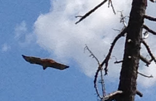
| On the left side of this dead tree perched a large hawk. |
 |
| After a rest, it flew away. |
 |
| In a moment, it found a thermal updraft, and it rose high up into the sky. |
Hiking Meyer's Grade is a great way to get a sense of what Tahoe locals do for everyday exercise. Come join us!


No comments:
Post a Comment