
Category - Easy
View Rating - 3 out of 10
Distance - Any distance you want, as this is an out-and-back round trip. Turn around when you desire. One of the easiest vista points is one half mile from the main parking area. If you're walking from a Stateline hotel, add another half mile each way. If you go to the Tahoe Rim Trail, it is about 5 miles round trip from the main parking lot.
Elevation gain - 200 - 1500 feet for the basic trail.
Let's say you're staying on Tahoe's South Shore near the state line, which features the city of Stateline, NV to the northeast of the line and Heavenly Village to the southeast of the line. This is where Tahoe's greatest concentration of hotels and motels are.
Now let's say you'd like to go on a nice hike but don't want to have to figure out transportation to a trailhead. No problem. There's a great hike within easy walking distance from your hotel. In less than 1 mile from your hotel, you can walk through the nearby forest to wonderful views. In less than 2 miles, the views are more expansive.
Years ago, the Van Sickle family donated their 542 ranch to provide for a park. The result is a very nice facility within walking distance from the busy hotel corridor near the state line.
The forest trails are relatively easy, the views are nice if not spectacular, and best of all, you can skip the car and walk from any of the area hotels.
To get to Van Sickle park, look for where Park Avenue crosses Hwy 50 (Lake Tahoe Blvd.) On the east side, what used to be Park Avenue is now called Heavenly Village Way. Walk east on Heavenly Village Way a long block to a four-way stop sign. The entrance to Van Sickle Park is straight ahead. (It is not well marked!)
 |
| Follow the red car straight into Van Sickle Park |
 |
| When you get to this old barn, take the turn to the left. |
 |
| This is the road that leads to the main parking area. |
 |
| There are restrooms and information signs near the parking. |
 |
| Look for this single trailhead sign. The main trail heads up behind the sign. |
 |
| The sign has a map of the trails, of which there are several. |
 |
| The trail is a single-track, but it is easy to navigate. |
 |
| Watch for this sign and a trail that leads to a great overlook up on the rocks. (Be careful at the top and use your hands for support. If you are unsure, don't climb up on them.) |
 |
| This is the view to the left. The mountain on the left is Mt. Tallac. Maggie's Peaks are in the center. Jakes Peak is to the right. Emerald Bay is tucked in below Maggies and Jakes. |
 |
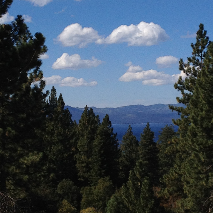
| View to the center |
 |
| View to the right, with the casino hotels visible |
 |
| As you continue up the trail, you come to the burn path from the Gondola Fire from several years ago. Someone tossed a cigarette butt out of the gondola, which started a huge forest fire that threatened all of the homes on Kingsbury Grade. |
Van Sickle Park has multiple trails worth exploring. You can walk all the way up to the Tahoe Rim Trail, which you will intersect near the ski lifts on Heavenly's Nevada side. From there, if you like, you can continue to Tahoe's grandest hikes and mountains. For example, it is possible to hike all the way to Freel Peak, a 30-mile round trip, which, at 10,880 feet, is Tahoe's highest mountain and would require a 4,500-foot elevation gain from Van Sickle Park. This is, of course, only for EXPERT hikers. But I point it out just to show that there is a vast territory available to anyone with a good pair of hiking boots and a pack full of clothes, food, and water. No car necessary.
Enjoy!
 |
As you leave the parking area and head back to your hotel, you get a nice view of Mt. Tallac!
|
No comments:
Post a Comment